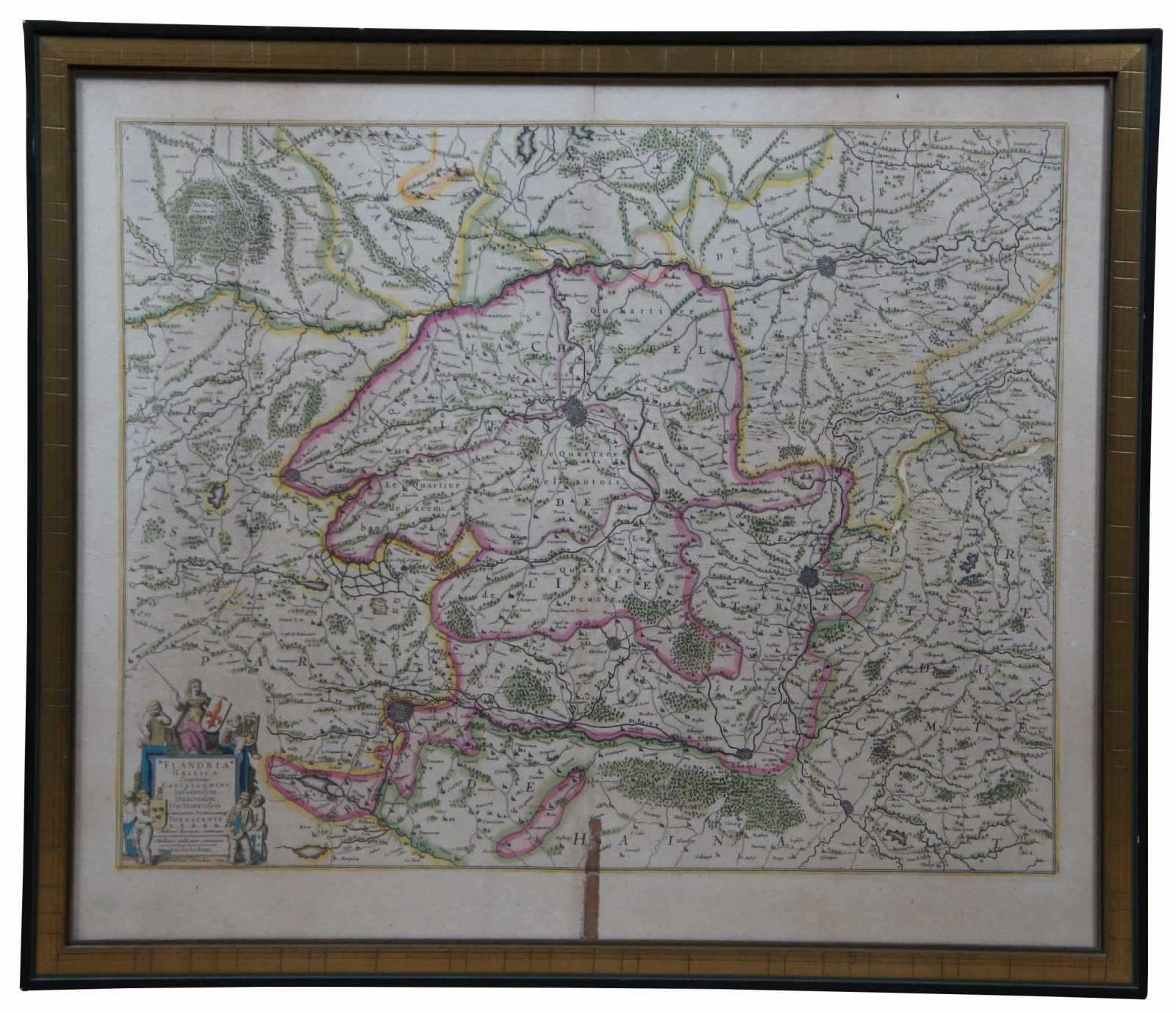


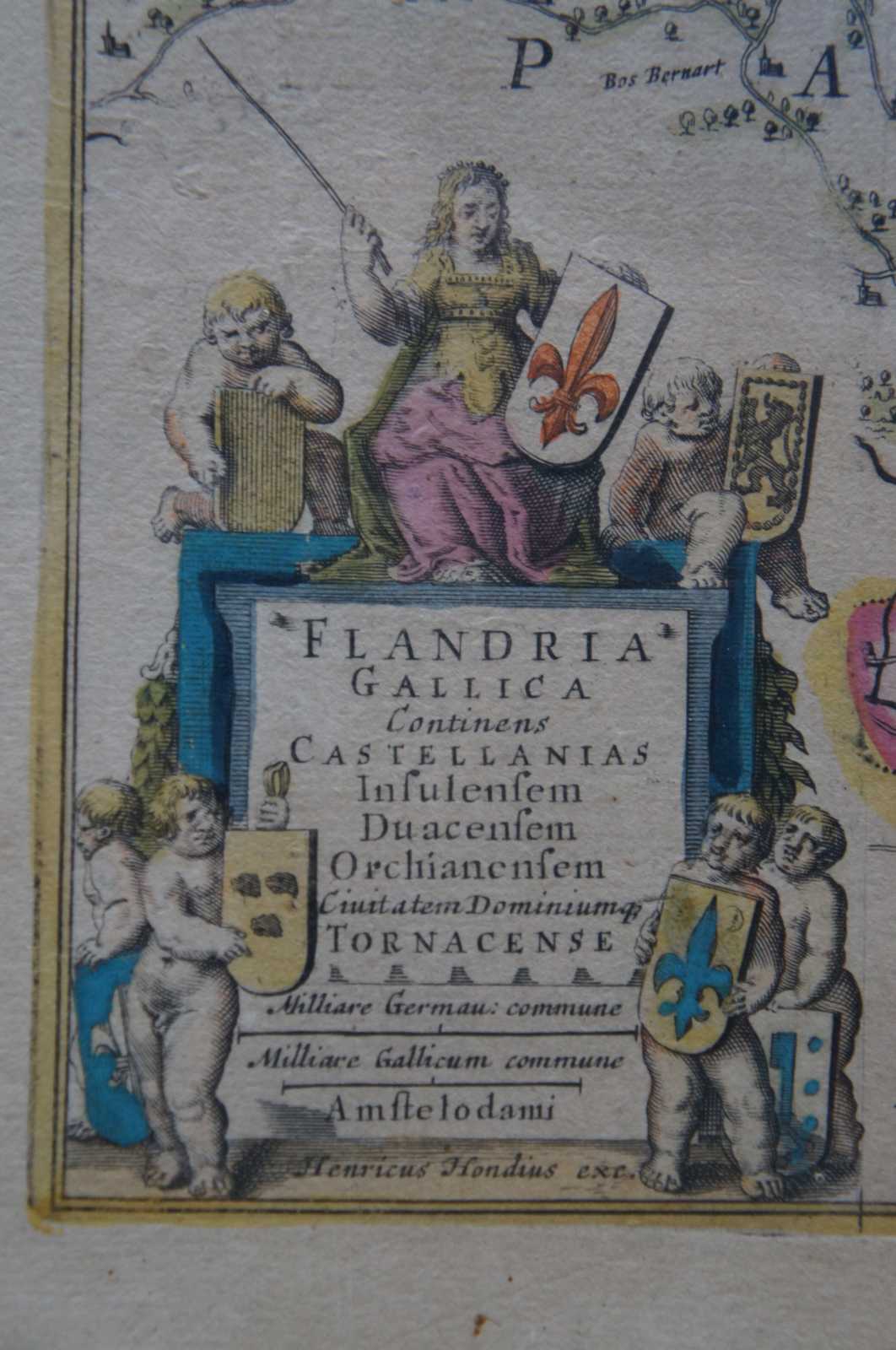
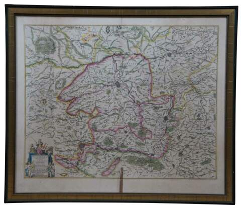
Antique 1630 Colored Belgium Map Flandria Gallica Flanders Henricus Hondius 23"
$280.00
Shipping:
Free Shipping Included
Delivery:
Estimated 2-15 Business Days
Payments:
Credit Card, Check, Cash, PayPal, Apple Pay, Venmo
Returns:
30 Days 100% Money Back Guarantee, Buyer Pays Return Shipping
Description
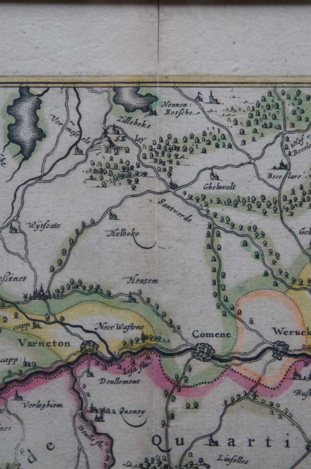
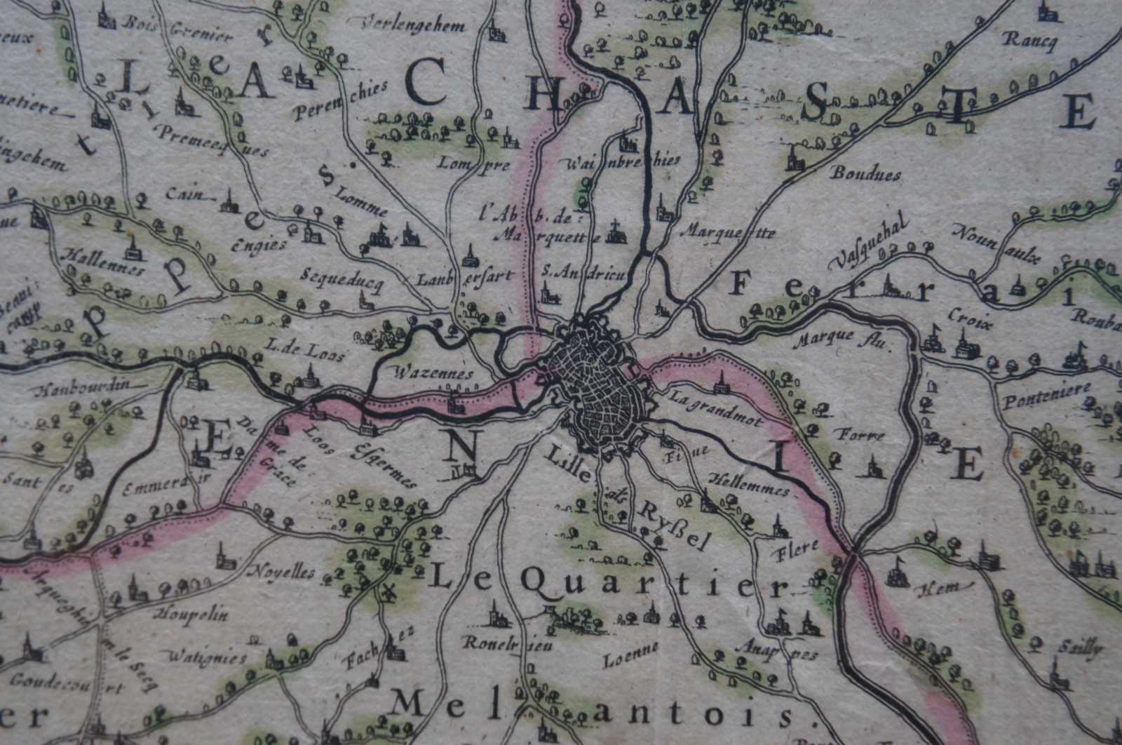
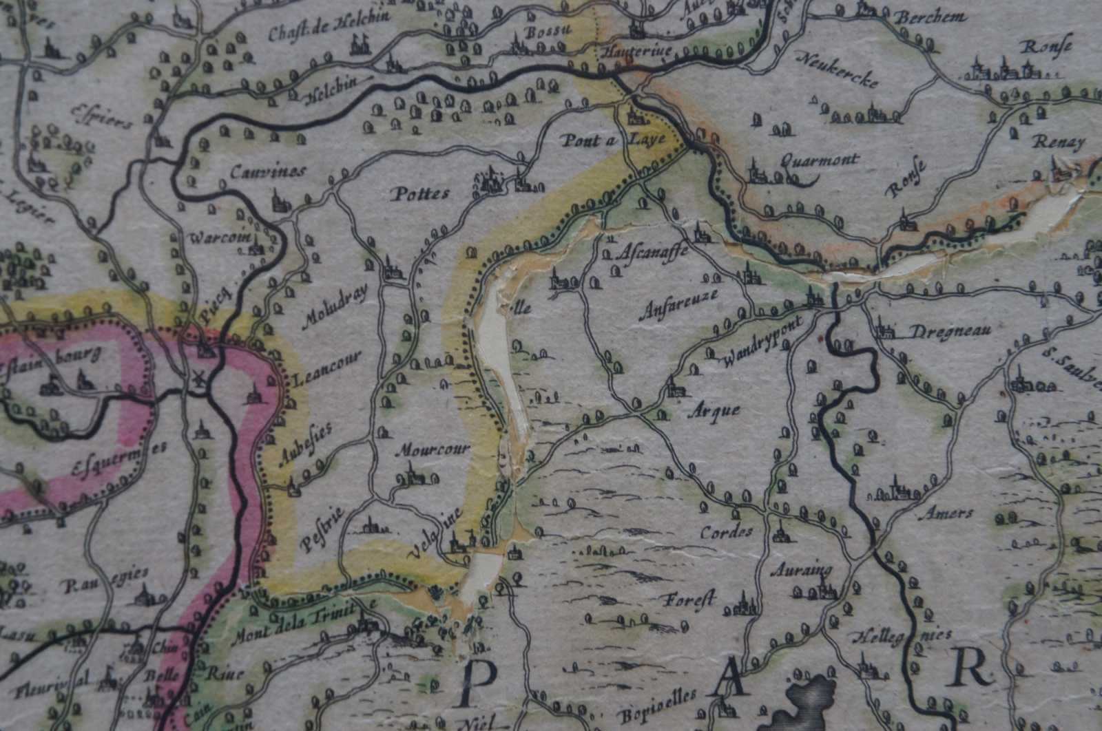
Antique hand colored map of Flanders, Belgium, circa 1630, engraved by Henricus Hondius. “Henricus Hondius II (1597 – 16 August 1651) was a Dutch engraver, cartographer, and publisher. He was born in Amsterdam, the son of the famous cartographer Jodocus Hondius who had started a map-making business in the city. Henricus obtained the original plates of the Mercator 1569 world map, and published a 1606 version of it. After his father died in 1612 Henricus co-ran the business with his brother-in-law.[1] In 1621 opened his own company in his hometown. The first time his name was mentioned in an atlas was in 1623 when he published the fifth edition of the Mercator-Hondius atlas. After 1628 Henricus partnered with the cartographer Jan Janssonius and together they continued the business. He died in Amsterdam.
He came from a different family from Hendrik Hondius I; there were two families engaged in very similar activities at the same time. “
Condition
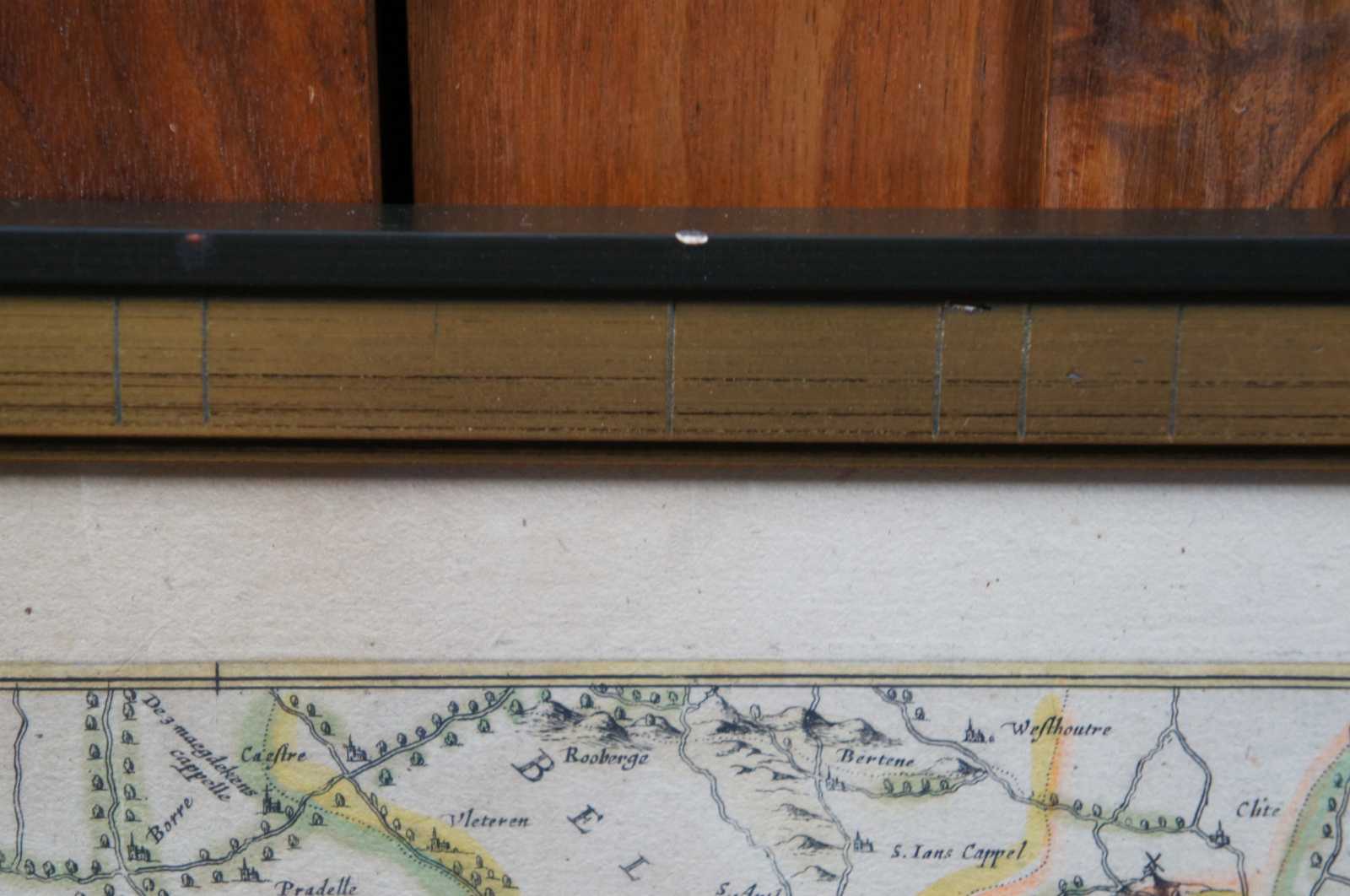
Good Overall - Crease down center; some holes/discoloration; dark stain (from tape?); see pictures
Dimensions
23.375” x 0.625” x 20” / Sans Frame - 21.25” x 18” (Width x Depth x Height)